MENU

HOME

HISTORY

housing

Activities

Trekking route

The hamlets of the Levanto valley

Route: Levanto Stazione F.S. – Levanto Passeggiata a mare

Length: 14 km

Walking time: h. 4.30

Trekking route

The hamlets of the Levanto valley

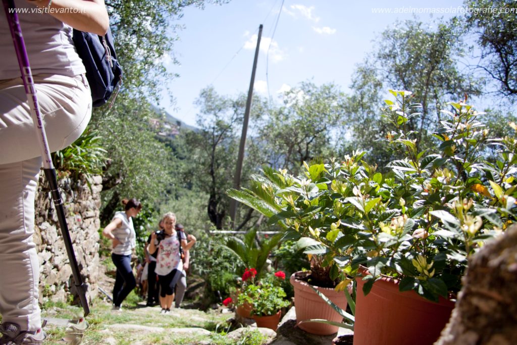
The itinerary takes place in the inland-western part of the Levanto valley, walking halfway up the coast and passing many small and characteristic villages. here is the itinerary. It is possible to do it partially.

Stazione F.S (m.10 s.l.m.).- Ridarolo ( m. 104 s.l.m.) -S. Bartolomeo ( m. 200 s.l.m.)-Pastine ( m.202 s.l.m.)–Lerici ( m. 133 s.l.m.)– Sorlana – Montale ( m.154 s.l.m.)- Casella ( m.106 s.l.m.)- Dosso (m.237 s.l.m.)-Groppo (m.202 s.l.m.) –Lavaggiorosso (m. 281 s.l.m.) –Lizza ( m.191 s.l.m.) –Crocetta ( m. 263 s.l.m.) -passeggiata a mare (m.3 s.l.m.).

We set off from the car park above the railway station. We walk along the "Moltedi" sports field, turn right at the church of N.S. della Guardia, cross the bridge and turn left towards Monterosso. After 100 m. After 100 m, in S. Rocco del Piano a comfortable mule track (C.A.I. path n° 575) begins, we proceed slightly uphill for about 15 min.
Once we reach the hamlet of Ridarolo, we cross it, leaving the church of San Giovanni Battista on our right, and we continue along the road until we reach the wide crossroads with the small church of S. Bartolomeo. Behind the building there is a drinking water fountain.
Here we cross path No. 570, which runs horizontally across all the "villas"; head north-west, following the signposts for Pastine-Montale. The slightly downhill path passes through a patch of pine trees, then chestnut trees, and finally, after a small bridge, climbs gently up through the olive groves, which are enlivened by the characteristic orange nets used for harvesting olives.
We now reach the village of Pastine. From the small square in front of the chapel of S. Maria Assunta, we turn right and, having passed the portico, continue to the left.
A short descent leads to the asphalt road - the old path is impassable - after about 300 m we leave the carriage road and descend the steep cemented road that will take us to the village of Lerici.
We come out in front of the chapel dedicated to Sant'Antonio da Padova and turn right among the houses. Keeping to the right, we descend until we pass the rear façade of an old, renovated stone mill. We keep to the path, which takes small twists and turns up the Fico valley, and climb up until we reach the houses of Montale, formerly known as Ceula. We enter the village and come out near the parish church.
The 18th-century façade of the parish church of San Siro conceals a valuable Romanesque structure: a stop to admire the interior is a must.


The route

Leaving the church square, we cross the road and, after a few metres, descend on the sn at a house.
We again walk among the olive trees and enter the valley until we come to a small shrine linked to the Marian cult at the crossroads. A characteristic little bridge allows us to cross the Dosso stream, leaving the ruins of a mill on the left and starting the climb that will take us to the hamlet of the same name. Let us pause to admire the architectural details of the houses and the slate Annunciation sculpted on the portal of the oratory dedicated to St John the Evangelist.
Having left the village, we follow the path again, which touches the tarmac road a little further down. We reach Groppo and climb back onto the carriage road. Pass the junction for Lavaggiorosso or, if you prefer, take a diversion to visit the village and the parish church of San Sebastiano.

Arrivati a Lizza il nostro sguardo spazierà sull’intero arco collinare e sul versante che abbiamo appena aggirato. Inoltriamoci nei ripidi passaggi voltati che confluiscono nel sagrato della cappella di Santa Maria Assunta. Ma il nostro percorso non è ancora terminato.
Dobbiamo ancora salire verso le rovine di un mulino a vento e raggiungere il sito delle vecchie cave dove veniva coltivato il famoso marmo rosso di Levanto. Tornati sulla carrozzabile imbocchiamo il sentiero alla nostra ds. all’altezza della prima curva.
Prendiamo leggermente quota e lasciate alle spalle le abitazioni, ci immettiamo, sulla sn., sul sentiero n° 671 che in questo tratto si percorre su strada bianca. In prossimità della zona chiamata Crocetta sono visibili le cave di pietra ormai abbandonate.
La vegetazione si è fatta rada e brulla, e mentre seguiamo nuovamente il sentiero, che attraverso il Monte delle Streghe ci porterà alla vista del mare, ci rendiamo conto della devastazione provocata dal non lontano incendio.
We descend in winding turns through the cysts, thyme and junipers, with nothing but sky and sea in front of us. Having passed the carriage road, we continue to descend until we reach the sea promenade and the beach.